Premium Map Layers
See every gravel road and pinpoint where rain has fallen with our AI surface + weather layers.


MapiBotPowered by:
What Do You Get with Our Tool?
Make sure all your tasks are organized so you can set the priorities and focus on important.
Connect to Strava
Auto-import your rides and get an AI-powered surface breakdown posted to each activity.
Just · $4 / month Connect Strava
MapiBot × Strava
Seamless Sync • AI Surface Intelligence • Instant Insights
Strava Sync + Surface Breakdown
Connect your Strava account once and every new activity is automatically imported in real time. MapiBot runs each ride through our advanced AI models on a high-performance compute cluster to classify every segment by surface type—gravel, pavement, mixed, and more. Results flow right back into your account as clean summaries and map overlays, delivering accuracy well beyond generic sources like OpenStreetMap.
- Auto-import: new Strava rides are ingested the moment they upload—no manual sync.
- AI classification: segment-level surface types derived from our proprietary dataset.
- Supercomputer processing: GPU-accelerated models for speed and consistency at scale.
- Instant insights: per-ride surface percentages, highlighted sections, and quick filters.
- Continuously improving: more rides = smarter models and more precise local context.
How Our Strava Integration Works
Seamless Activity Import
The moment you upload a ride to Strava, it flows directly into our platform. No extra steps, no manual syncing— every activity is captured in real time so you never miss a detail.
AI-Powered Surface Analysis
Each ride is processed on our high-performance supercomputing cluster, where advanced AI models classify every segment of the route by surface type. Gravel, pavement, mixed—our proprietary dataset makes the results far more accurate than anything from OpenStreetMap or other public sources.
Instant Results, Smarter Insights
Insights are pushed back to your account automatically—giving you a clear breakdown of surface types, ride conditions, and terrain context within seconds. The more you ride, the smarter the data becomes.
Premium Layers.
Access the API
MapiBot Premium gives you advanced AI-powered map overlays. Explore accurate road-surface insights, near real-time saturation data, and more layers on the horizon.
Sherpa Map LLC
Creators of MapiBot.png)

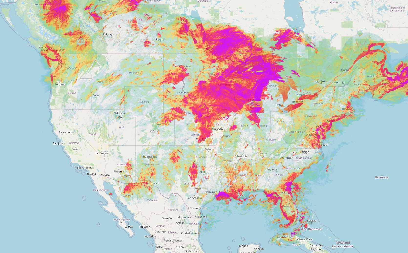
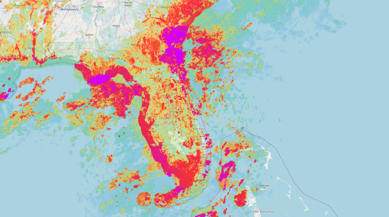
Premium Map Layer: Real-Time Saturation Insights
Our Saturation Layer updates every 2 minutes and shows 48 hours of post-rain radar data. Using AI, topography, and ground type, it predicts what’s drying quickly and what’s still wet — so you can choose the fastest, driest route.
Track ground saturation in near-real time.
Our 48-hour saturation layer updates every 2 minutes and visualizes post-rain radar as precipitation. An AI model blends reliable live weather sources with local ground type, tree cover, and topography to predict what will dry—and what won’t.
Open the Saturation Map- 48-hr rain history
- 2-min updates
- AI saturation maps
- Terrain & tree cover
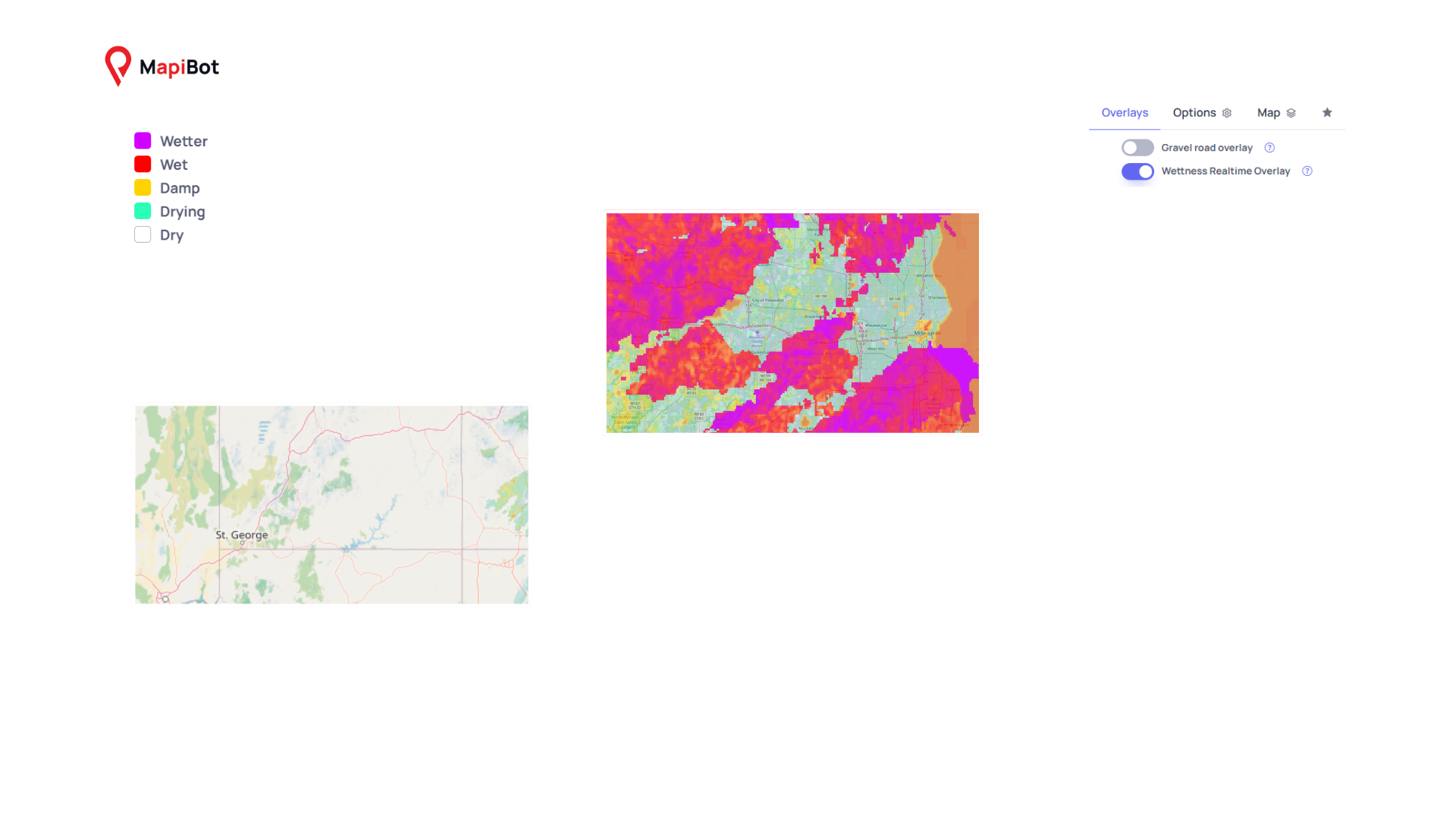
MapiBot Waypoints
Storm Trace • Waypoints • Wetness Status
Waypoints + Rain-Saturation
Drop and name waypoints—like your favorite MTB parks—and turn on the Rain Saturation overlay to see live ground-wetness at each spot. MapiBot samples the saturation tiles around every waypoint and assigns a simple status label so you can quickly tell if a park is likely rideable right now.
- Wetter: heavy recent rain; expect mud / standing water
- Wet: saturated and soft; ruts likely
- Damp: tacky in places; good grip with occasional soft spots
- Drying: improving conditions; patchy dampness remains
- Dry: little to no recent rain; hard and fast
.png)
.png)
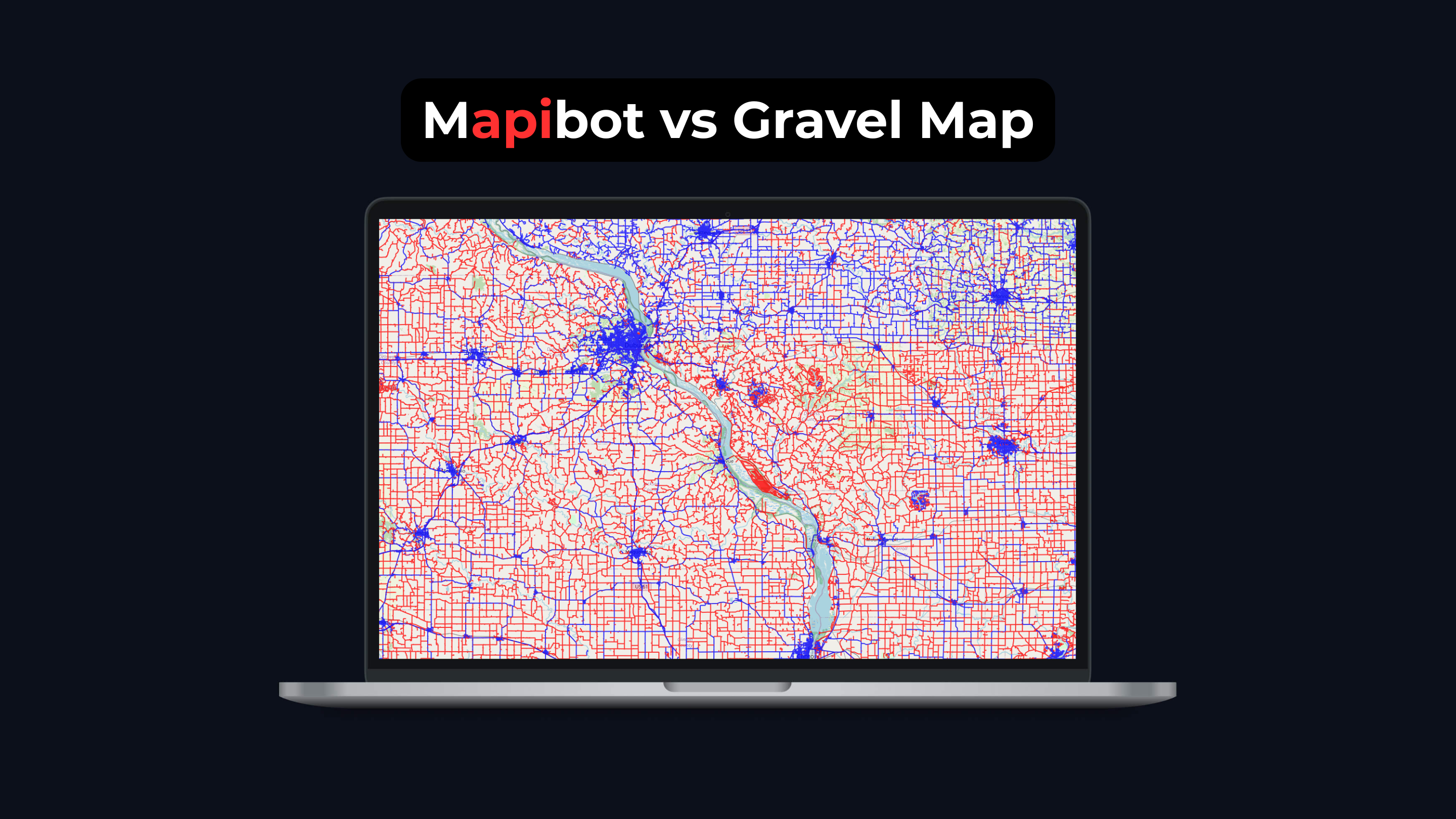
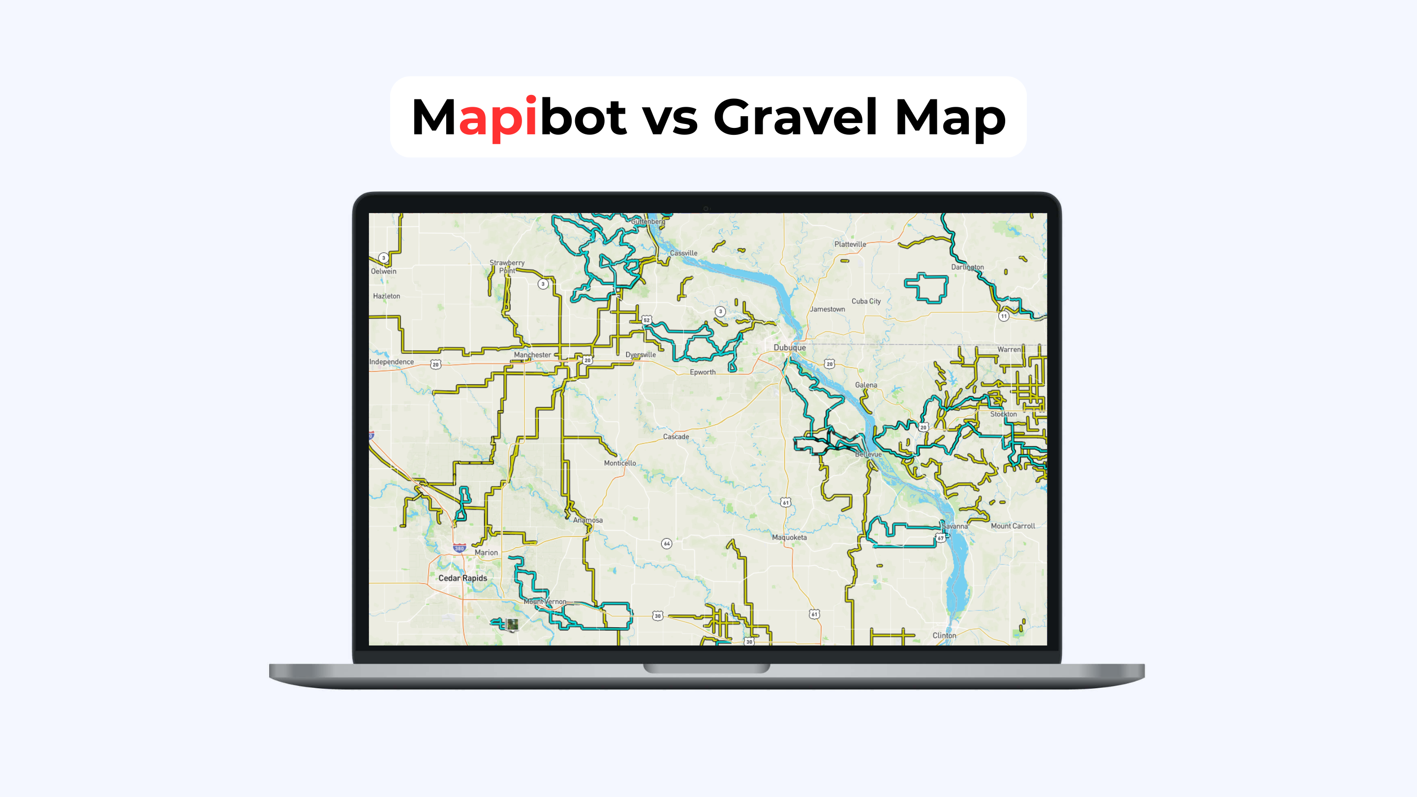
Premium Map Layer: Explore Gravel Like Never Before
Our AI-powered Gravel Layer highlights unpaved roads with precision. See where the real adventure starts, plan smarter routes, and ride with confidence.
Discover gravel roads
Our gravel layer makes it simple to spot hidden backroads, rural connectors, and unpaved adventure routes. Built from verified sources and refined with AI, it highlights the best gravel riding options right on your map.
Explore the Gravel Layer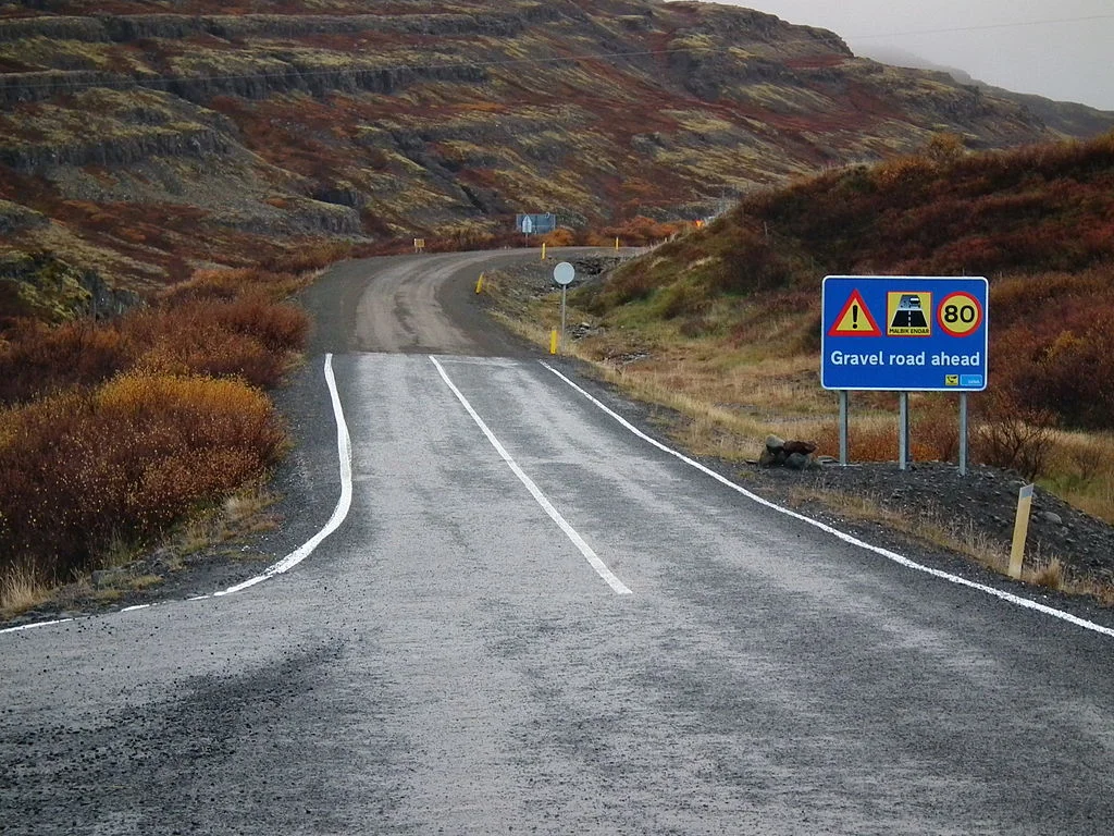
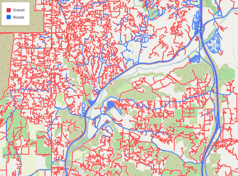
Accurate road type identification
Our system doesn’t just mark a line on a map—it classifies surface types, identifies transitions, and distinguishes gravel from pavement or dirt. Combined with tree cover, terrain, and local ground conditions, you get a clear picture of what to expect.
- Clear visual distinction between paved and unpaved roads
- AI-enhanced accuracy using satellite and ground data
- Real-world tested by cyclists and adventurers
MapiBot Surface Insights
Gravel • Pavement • Confidence 0–1
Confidence Ratings
We display a confidence score for each road-surface classification so you can judge how certain our models are. Scores range from 0 to 1 — where 0 means no confidence and 1 means 100% confidence in the predicted surface type (e.g., gravel vs. paved). The example below shows outputs on this 0–1 scale.
- 0.00: No confidence
- 0.01–0.49: Low confidence (use caution)
- 0.50–0.79: Medium confidence
- 0.80–1.00: High confidence (near 100%)
Strava Sync
Auto-import rides + AI surface breakdown on every activity.
Free Trial
- • Full access to AI-derived map layers
- • Surface-type overlays (gravel / paved / mixed)
Premium — Annual
- • Everything in Free Trial
- • Priority updates & faster refresh
Premium — Monthly
- • Everything in Free Trial
- • Priority updates & faster refresh
14-day free trial, then $3/mo billed annually or $5/mo billed monthly. Cancel anytime.